- Difficulté Facile
- Distance 12km
- Maximum altitude 355m
- Altitude minimum not disclosed
- Walk 03h30
- Positive elevation gain 287m
- Negative elevation gain 287m
- Commune de départ Larnas
Description
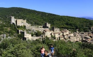
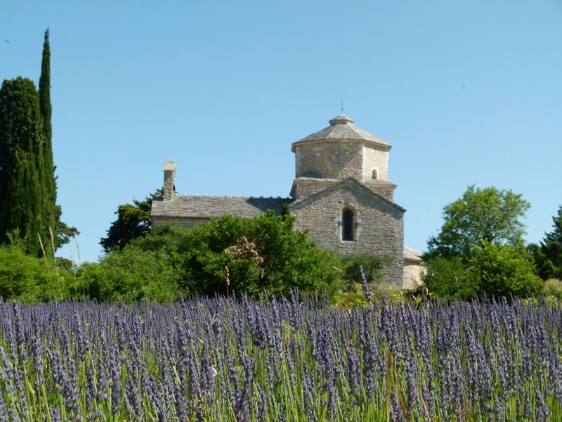
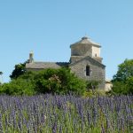
Beautiful varied circuit both in terms of the paths taken and the landscapes. Very beautiful views of the lavender plateau, the Dent de Rez, valleys and wooded ridges.
Learn more-
Address
- Office de tourisme de Larnas
- Mairie
- 07220
- Larnas
- website
- Phone 04 75 54 54 20
-
Opening
All year round.
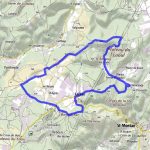
Localisation
Departure from the town hall 1414 Route de Saint-Remèze (RD 262), 07220 Larnas (parking at the back). From the hiking info panel, next to the Town Hall, go to the church St Peter's Church is a fine example of art 12th century, to visit. Follow the white and yellow markings (PR). Climb the small road until you arrive under the high voltage lines. At an electric pole, take the path to the right. Do not turn right towards the pylons nor to the left towards the road. Continue on this path until the post "Bois de Deniéret" (1). Take the direction of Viviers and follow the path down through the forest. Arrived at a hunter's hut, turn left towards the paved road and left again. At the farm on a ridge, continue straight and at the junction shortly after, do not go towards Larnas on the left but enter the dead end in front of you. At the end of this street, go straight and take the path that crosses the forest. When this leads to a wider path, bear left; and, at the next junction (about 400m further on): post "Gandaubert". (2), Turn left towards Larnas - Fontaine du Buis.
Stay on this track until you reach a road. From the cross, there is a beautiful view of the Nègue valley. You have to take the road to the left for 80 m then turn right on the path that goes up.
Note: you have traveled 7km, it is possible to easily return to the car park by staying on this pretty little road and turning left at the next road junction (return in 1.7km unmarked).
Continue on this path, and at the 2nd intersection turn right following the PR markings. Turn left onto the road; and, 270 m further, on the right on the path crossing the lavender fields. Stay on this path +/- 900m, then take a path on the left between 2 small walls
Continue on this path which extends into a street and go to the junction with the D262.
To cross. At the Calvary, post "Fontaine des Buis". (3) follow St-Montan. Stay on the wide path that goes up to the "Bas Rocher" post (4). Follow: Larnas 1.1 km via La Peyrière
At the post: "La Peyrière" (5). Take the path down to the left direction: Larnas 0.7 km. At the bottom of the path, a barrier to open and close to continue straight (do not go up to the left). In the village, pass under the arch to reach the town hall.
Tip from Vincent: This hike is especially beautiful in the spring with the wildflowers and mid-June to mid-July with the lavender fields of the Laoul Plateau. In May, go see the irises in the Nègue valley, in Gerbaux.
Can be combined with the La Sainte Beaume circuit to see Saint-Montan.