- Difficulté Facile
- Distance 11.6km
- Maximum altitude not disclosed
- Altitude minimum not disclosed
- Walk 03h30
- Positive elevation gain 200m
- Negative elevation gain 200m
- Commune de départ Saint-Marcel-d'Ardèche
Description
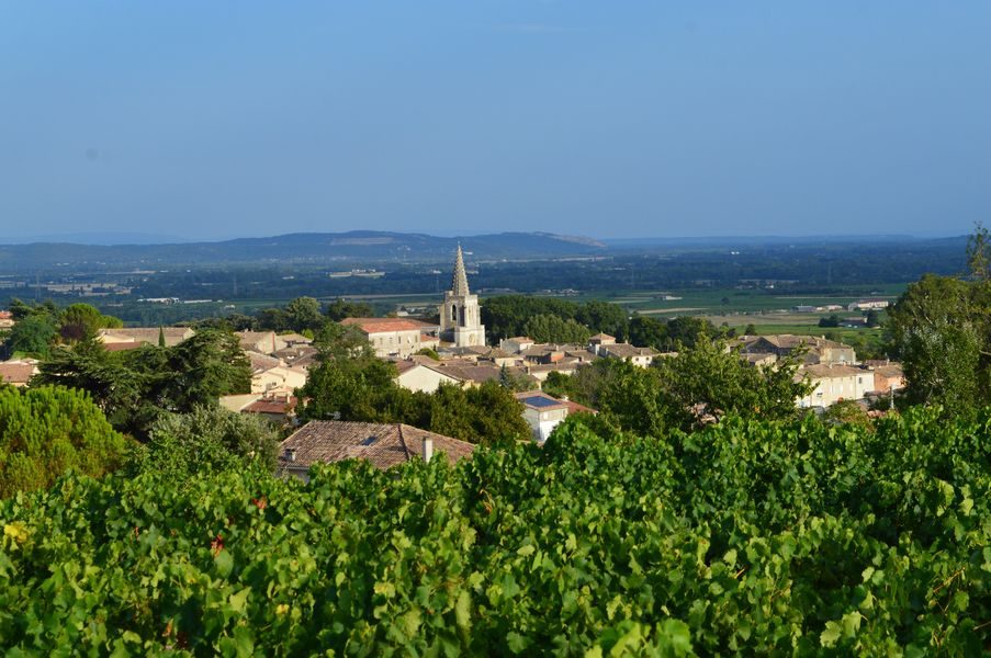
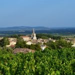
A very pretty hike in the countryside, especially when the vines are decked out in their autumn colors. The long route takes you up a dry stream bed in the unusual Combe du Chat.
Learn more-
Address
- place du Ponteil
- 07700
- Saint-Marcel-d'Ardèche
- website
- Phone 04 75 54 54 20
-
Opening
All year round.
Localisation
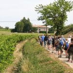
From the "info rando" sign, near the old Saint-Marcel post office, pass the square with the wash-house, then take the lane on the right "rue de la Fontaine de Viviers"; then right on the square and left on the 1st street. Then right along the church. At the end of rue du Barry, turn left, then 1st right, then 1st left. After 80 m, take the road on the right which climbs steeply towards the St-Joseph chapel.
Continue along this road. At a fork in the road, do not turn right. At the end of a wood on your right, turn left. At the "T" turn left, then right at the 1st track. Continue along the main road until you come to a small tarmac road on the right.
At the "Souchas" sign [1], you have 2 options:
For the 5.6 km circuit, follow the GR (white and red markings) to "La Capelade (0.7 km)" on the left. Follow the road downhill for +/- 500 m, then take the path in the direction of the road. When you reach the main road, cross it and turn right. At the "La Capelade" post [1b], turn left towards "Plan de Lage (0.5 km)" [6]. The road becomes a dirt track.
For the 11.6 km circuit, follow signs for "Chapelle St-Julien (0.3 km)". At the "Chapelle St-Julien"[2] post, leave the road and climb a little, straight on to "La Garoune Bas (0.8 km)". After admiring the chapel and its bucolic setting, take the first track on the left. It twists and turns down to the road.
At the "La Garoune Bas" post[3], turn right towards "La Garoune (0.2km)". Before the road bends, go left up to a house and go well round it to the right (signposted on the electricity pole), then down the path in the undergrowth. Turn left onto the road. You'll see the "La Garoune" post[4], turn left and follow the bed of the Combe du Chat stream for 1.65 km to a wide path. Turn left and continue right at the fork. When you reach the main road, take the path that runs alongside it to the right. At the second track on the other side of the road, cross over and turn right. When you reach a road, follow it to the left as far as Labégude. Turn left just after the large stone building. Follow the farm track until you come to a road and go down it to the "Champ de Grézas" sign[5]. There, turn left towards "Plan de Lage (0.5 km)". After the Domaine du Chapitre, go down to the right and follow this road, which then turns left.
At the "Plan de Lage" post[6] {junction of the 2 circuits} follow signs for "Saint-Marcel" via "Lafare (0.4 km)".
At the "Lafare" post[7] follow signs for "Saint-Marcel-d'Ardèche (1 km)" and go straight up. Stay on the main road until you reach a tarmac road. Turn left and, after 150 m, cross the R.D. Follow the road downhill. Pass the sports fields; go straight on to the calvary, then turn right onto "rue du Barry ouest" to return to the start.
To extend the circuit by 1.4 km, at the "Lafare" post[7], turn right towards "Peyrobe"[8], then left; after 100 m, at the "Chaveyron" post[9], turn left to return to St-Marcel.
Vincent's advice: this hike is at its most beautiful in autumn, when the vines take on their flamboyant colors.
The 13 km circuit can be connected to the Chapelles de Saint-Just circuit at the "Peyrobe" post, by turning right towards the beautiful Saint-Sulpice chapel. You can then do a total of 24 km, which connects to this circuit at the "Chaveyron" post.